How Satellite Prevented a War for Water
Have you ever been really, really thirsty? Not just dry-mouthed in the middle of the night or longing for a cold drink after an afternoon in the sun. But truly parched? Probably not.
In developed nations, hydration became a mantra, and water bottles became a fashion accessory sometime in the past 10 years. No doubt, we are all better off for it. But for most of the world, access to water for drinking, cooking, bathing, irrigation and industry is a serious and rising concern.
Today, one out of every four human beings lacks access to safe drinking water. About half of Earth’s people experience severe water scarcity for at least part of the year. Adding to their woes, water scarcity means food scarcity, because it takes between 2,000 and 5,000 liters of water (500-1,300 gallons) to produce one person’s daily food. All this is, ironically, at a time when excessive rainstorms and massive flooding are also a rising challenge.
Numbers like these have led experts to predict that future wars will be fought over access to water. Actually, you don’t have to be much of an expert to make the prediction. According to a web page called Water Conflict Chronology, we have been fighting over water since at least 2500 BC, when the king of Lagash in Mesopotamia built canals to cut off the water supply to the neighboring kingdom of Umma. In this century, Ukraine built a dam to cut off water to Crimea after Russia seized that territory; last year, Russian troops blew it up while invading Ukraine. The website totals 1,300 conflicts that have arisen over water.
But a future of aqueous conflict isn’t inevitable. The example of Egypt and Ethiopia points to a better path – one made available by satellite technology.
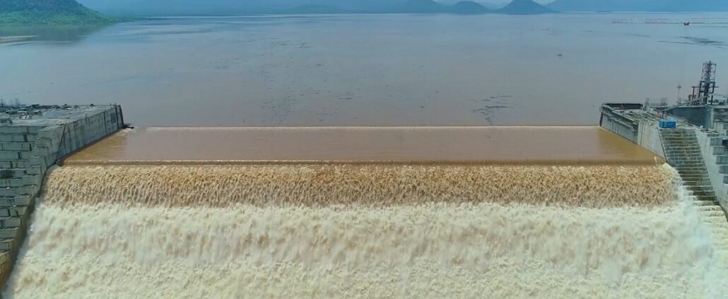
In 2011, Ethiopia began building a massive dam on the Nile River. It was called the Grand Ethiopian Renaissance Dam, signaling its importance as a producer of electricity the country’s economy badly needed. Downstream, however, Egypt depends on that river for most of its water and began voicing serious concerns to anyone who would listen. When Ethiopia began filling the dam in 2020, Egypt demanded a promise that, if the rains failed, Ethiopia would release enough water to keep the river flowing. Ethiopia refused.
And there it was – the opportunity for the world’s next water war, as Egypt, the biggest military power in the region, considered its options. But war has not broken out, and data from space is a major reason.
Earth observation satellites are capturing both visual imagery in ever greater detail and radar images using synthetic aperture radar (SAR), in which the motion of the satellite over the ground generates finer spatial resolution than conventional beam-scanning radars.
SAR was particularly important in this case because the rain clouds that filled the reservoir of the dam made visual imagery useless. But turning that radar imagery into something decision-makers could rely on took special expertise. For Egypt and Ethiopia, that came from Ursa Space Systems, which generates satellite intelligence from a growing catalog of 11 million SAR images. Ursa Space engineers measured changes in the size of the Ethiopian dam’s reservoir over time.
Using that data, Ethiopia could prove it was managing water flows without endangering Egypt or other downstream countries. Egypt could check the same data whenever it had concerns about the flow of the river. And two nations with no other reason to fight could find better ways to resolve their differences.
The people of the satellite industry build technology, launch it, fly it and profit from it. But that’s not really what they do for a living. What they really do is drive economic growth, feed and educate and connect people, improve and save lives, and even help save the planet. And generally, it’s not charitable work. It’s just another day in the high bay or control room or office, just one more day spent quenching the world’s thirst for a better life.
This article is republished from ViaSatellite. Read the original article.


 IEEE.org
 Getty
Getty Getty Images
 Getty Images


 Wikipedia
Leave a Reply
Want to join the discussion?Feel free to contribute!